

Railway to conduct airborne lidar survey of Lumding – Badarpur Hill Section

Northeast Frontier Railway (NFR) is all set to conduct airborne electromagnetic lidar survey at the critical locations of Lumding–Badarpur Hill Section.
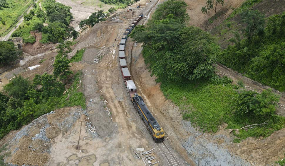
Of late, train service through this hill section has been suspended due to damage of tracks at the New Haflong-Chandranathpur section in Dima Hasao district on May 30.
The railway authorities have to suspend the movement of trains during monsoon every year due to the damage of the railway track by rain and landslides in the Lumding-Badarpur Hill Section stands as a vital railway artery in Assam, operating under the Lumding Railway Division.
LiDAR (Light Detection and Ranging) technology is used to obtain highly detailed and precise elevation data. A LiDAR survey is conducted using airborne or terrestrial LiDAR scanners to capture the topography of the project area, including the existing railway tracks, nearby terrain, and any relevant structures.

“The survey will be conducted during and after monsoon which will analyse the critical location in detail for the type of soil strata, stability of the slope, presence of natural or formed fault tending any movement of hill, water accumulation beneath the soil strata, formation of slip circle and stability of hill toe,” NF Railway spokesperson Sabyasachi Dey said.
The survey will be conducted between Lumding–Badarpur section at KM–45 to KM–125.

“The tender for the survey has already been finalized and awarded to a Noida-based company M/S Garudauav Soft Solutions Private Limited. Airborne ground surface survey and subsurface electromagnetic survey based on robust digital twin based AI-powered one point monitoring system will be conducted,” De said.
“This will monitor the dynamic geophysical landscape and subterranean environment which will help in identifying & analysing of failure/critical areas for preventive maintenance of the track environment without substantive human interventions along weak and vulnerable location prone to landslide/slip,” De also said.
This will be done by using non-invasive sensors i.e. LiDAR, Optical Photogrammetry, Infrared mapping ground-penetrating Radar & Airborne Electromagnetic. The result or output will be analysed by Artificial Intelligence software for better comparison of thousands of data generated by survey and remedial measures will be provided for such critical location.
“Railway surveying projects involve a range of surveying activities and techniques to support the planning, design, construction, and maintenance of railways. This survey plays a crucial role in ensuring the safety, efficiency, and effectiveness of railway transportation systems,” he added.


Leave a Reply